Here’s a scenario: You have a question over a trivial event from history, say the mighty Eighteenth century. It niggles. So what can you do to get an answer? Quickest way is to 1. Search the internet (actually, most stuff from the world isn’t on the internet at all). You could 2. Find a book and read for your answer (such hard work without a guarantee, even from a comprehensive index!). Or you could 3. Find a scholar and ask (after searching the internet first). Of course, it all depends on how trivial your question is. I had one such unimportant question recently, popping up at me while reading James Boswell’s Journal of a Tour to the Hebrides with Samuel Johnson. Here’s the question:
‘Where exactly did Boswell’s party of travellers land in Fife after they crossed the Firth of Forth on Wednesday, 18 August 1773?’
It’s hardly ‘Who killed JFK’ (or JR), is it. But a Boswellian, someone who spends too much time pondering Bozzy and his life, would want to know such things. Maps in various editions of Boswell and Johnson’s accounts show the dotted line of travel leaving the port of Leith near Edinburgh, crossing the Forth and making landfall at Kinghorn, but Chapman’s 1924 edition combining both Boswell and Johnson’s accounts into a single volume has a fold-out map clearly showing landfall at an unnamed location on the Fife shore and then the line of travel moving up the coast a little to arrive at Kinghorn. And what of my ‘Bible’ on all things Boswell-Johnson-Scottish-tour: Ronald Black’s To The Hebrides has a map showing landfall at Kinghorn. This is crazy, right!
What do the texts say? Once again, I consult the trustworthy To The Hebrides for the latest thinking on these types of geopolitical questions. Boswell says only, “We dined at Monro’s in Kinghorn,” and no mention of landing their sailing vessel. Johnson’s account says, “We dined at Kinghorn,” also no reference to landing ashore. Conversely, Virginia Maclean in her excellent cookbook Much Entertainment, based around the meals on this 1773 adventure, says, “After landing at Kinghorn in Fife, they dined at Monro’s…” Also, Note 103 in Black’s To The Hebrides reads: “Monro’s was probably at Pettycut harbour, half a mile south-west of Kinghorn…”
By this point I’d had enough. The imprecision was too great. I had a brainwave and found the local history group for that area and emailed them. Within days I received a reply from the Royal Burgh of Kinghorn Historical Society.
How about this for a reply:
From the time that the pier at Pettycur was rebuilt in 1759 most of the ferry traffic from Edinburgh came into Pettycur. Both Kinghorn and Pettycur harbours had been destroyed in a great storm in 1625.
There was however, a problem with sand silting up Pettycur Harbour preventing larger vessels from getting in. In 1801 an engineer, John Rennie, was asked to design a scheme to shift the sand. He produced a map with his design on it showing the pier and a large building at the end of the pier. This building I believe was the original Pettycur Inn. Now long gone and now replaced by a modern house. A new Pettycur Inn was built in 1795/6 which replaced the old structure, which was in a state of dilapidation.
It’s difficult to find the name of the landlord of the inns as they were seldom the owner of the property. The owners can often be traced in land records, but there are no records of licenses or landlords.
The coaching route from Pettycur travelled down the present Pettycur Road, along the Westgate, and then I believe it dived down Cuinzie Neuk to the Tron (St Leonards Place did not exist). It then turned back uphill and travelled up the Overgate (north and south), and up through Townhead and the Gallowgate. There is a staggered junction on the Loch Road between Kinghorn and Burntisland. It would have gone north over the junction until it reached the old coaching route between Burntisland and Kirkcaldy . From Kirkcaldy the route went up through New Inn (roundabout near Falkland) where horses were changed, and then to Cupar.
And the answer to my question: ‘Where did they land?’ Well, detail from KHS and Black seem to agree, Pettycur was probably the landing place for the Boswell party.
Now, that’s not the entire email which I got back, but it demonstrates the depth of knowledge there is to be found out there. There must local history societies covering every square foot of Britain, populated with people whose knowledge of their locale is deeper and more specific than any scholar. Thanks so much to the local history boffins at the Kinghorn Historical Society for showing that further digging can still be done. The two accounts of the tour of Scotland are full of trivial (I mean ‘hugely important’) questions whose answers undoubtedly lay in the heads of local history afficionadoes. If any such historians receive an email from me in the future (say the departure and landing sites for crossing the Tay, the site of the bookshop in Inverness or the river in Mull where Johnson’s walking stick was lost) then please treat it kindly.
Notes
To The Hebrides. Samuel Johnson’s Journey to the Western Islands of Scotland and James Boswell’s Journal of a Tour to the Hebrides, (ed) Ronald Black (2007)
Tour to the Hebrides, RW Chapman (1924)
Much Entertainment: A visual and culinary record of Johnson and Boswell’s tour of Scotland in 1773, Virgina Maclean (1973)
Notes Extra
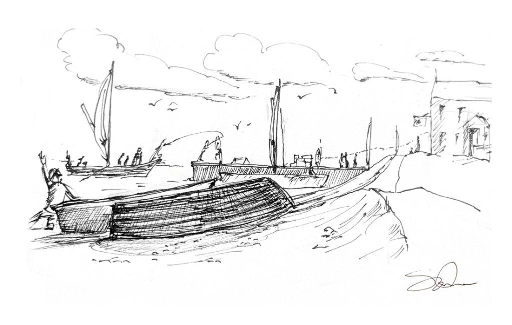
The illustration that accompanies this post is supposed to evoke travellers arriving into Pettycur harbour. I did a search for “John Rennie” + “Pettycur” and what I found (eg. Scapetrust.org) strongly suggests my sketch looks nothing like Pettycur harbour would have looked! Groan. It’s supposed to ‘evoke’. That’s what I say and I’m sticking to it.

Eighteenth century fans: Leave your comments here